Showing posts with label Hippo Pools. Show all posts

Sunday, 12 October 2014

DAY BY DAY ACCOUNT OF MY 2011 NAMIBIA TRIP - DAY 10 (2011-05-22)

See the previous installments at http://groblerdupreez.blogspot.com/


Ruacana Falls


Last night we camped at the Hippo Pools Camping site. Up early and off without breakfast to catch the sun rising at the Ruacana Falls.

Rene deciding what to paint

A more dramatic studio could not be imagined...


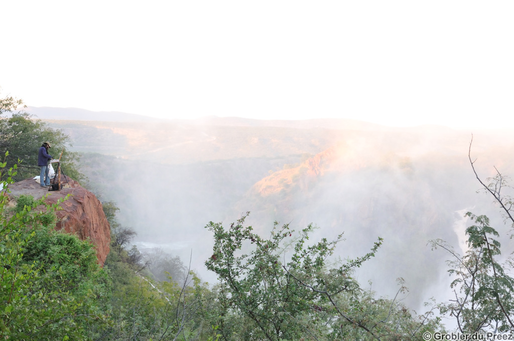
A spectacular sunrise at the top of the Falls

Marlene preparing breakfast near the main viewpoint. The fence visible to the left is the Namibia - Angola border.

Marlene and Rene enjoying the magnificent scenery
Rene busy with another painting as the sun is starting to set over the falls.

Back to the Hippo Pool for a lovely sunset and an enjoyable evening next to the camp fire

Distance traveled for the day: 42 km including a trip to the Ruacana town for some groceries

The map below is an interactive Google Map showing the actual GPS track we followed, imported from a .gpx file. Zoom in to follow our route. Double click on a balloon for more information.

Monday, 22 September 2014

DAY BY DAY ACCOUNT OF MY 2011 NAMIBIA TRIP - DAY 9 (2011-05-21)

See the previous installments at http://groblerdupreez.blogspot.com/


Outapi (Ombulantu Baobab tree) - Ruacana Falls


We camped the previous night below the baobab tree. Early up to get a few shots during the golden hour...

...and then breakfast at our camp below the Ombalantu Baobab Tree.
We took a guided tour of the tree. The tree is naturally hollow inside and can seat about 20 people. See more of it's rich history: Ombalantu


Marlene and Rene studying the visitor's book inside the tree

We departed to Ruacana Falls, 15 km past the town of Ruacana. From Ruacana, the road descends quite steeply to the Falls. The Calueque Dam in Angola is visible in the distance.

The Kunene River drops into a 700m wide x 120m deep ravine just below the Calueque Dam.

Marlene and Rene enjoying the view.


We set up camp at the Hippo Pools, a few km's below the falls

Lunch at Hippo Pool campsite. Quite hot in the middle of winter...

Back to the falls after lunch - here Rene is busy with a colour study of the falls from the viewpoint at the hydroelectric power station.


...then a colour study at the top of the falls... To reach the main viewpoint, you have to go throught the border post on the Namibian side - no formalities if you only visit the falls.

A Baobab tree in the falls

Sunset on top of the falls
Distance traveled for the day:  100 km, all tar

The map below is an interactive Google Map showing the actual GPS track we followed, imported from a .gpx file. Zoom in to follow our route. Double click on a balloon for more information.